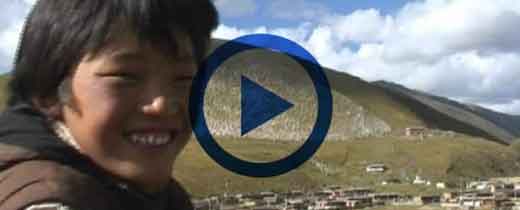
Tianjun County, also known as “Bongtak Tianjun County”, belongs to Haixi Mongolian Tibetan Autonomous Prefecture of Qinghai Province. It is located in northeast of Qinghai Province, northwest of Qinghai (Kokonor) Lake, east of Qaidam Basin.
Location
It borders Qilian County and Gangcha County in east, Gonghe County and Ulan County in south, Delingha City in west, and Subei Mongolian Autonomous County in Gansu in northwest.
It is only animal husbandry county in Haixi Prefecture, in which coal and animal husbandry are main industries. Tianjun County is a transliteration of “Tianjun Mountain”, one of thirteen famous mountains around Qinghai Lake.
Best time to travel
From July to September
Local climate
Plateau continental climate
Most popular sites
Tianjun Mountain, Tianjun Mountain is one of 13 famous mountains around Qinghai Lake and it is regarded eastern gateway of Qaidam Basin. Buha River, “mother river” of Qinghai Lake, originates from mountains in north. Tianjun Mountain is full of pine and cypresses, with green grass all over mountain.
Hala Lake is second largest lake in Qinghai, also known as Black Sea, with an area of 593 square kilometers and an elevation of 4,077 meters. Hala Lake is a large saltwater lake in inland basin on Qinghai-Tibet Plateau. Hala lake is fed by many small rivers that originate from surrounding mountainous with a peak of 5,600 meters. This is a place with abundant water and grass in hinterland of Qilian Mountains. It is an important breeding ground for wetland birds, anser, sandpiper, and gull. Large populations of yellow fish live in lake.
Lumangou Rock Paintings are located in southwest of Tianpeng Township, Tianjun County. Its valley goes from southeast to northwest. There is Xining-Tianjun highway crossing at entrance of valley. East and west sides of valley are high mountains. Mountains and valleys are densely covered with grass. About 4 kilometers in valley, there is a rock mountain on east side. Surface of these rocks has a layer of oily black shiny oxide surface, painting are on those rocks;
Geography and Climate
Tianjun County is about 44-170 kilometers wide from northeast to southwest, and about 312 kilometers long from northwest to southeast. It has a total area of 25,700 square kilometers, high terrain and cold climate.
Topography of Tianjun can be summarized as: six major waters, five major mountains, plains between hills and valleys, 43 large and small rivers, lakes and swamps with glaciers; high in middle, low at both ends, wide in southeast and narrow in northwest, shaped like a wedge; The highest altitude in Tianjun County is 5827 meters, the lowest altitude is 2850 meters, relative elevation difference is nearly 3000 meters, and average altitude is more than 4000 meters.
Tianjun County has a plateau continental climate with low temperature and uneven precipitation time. Its climate is cold, there is no absolute frost-free period, and annual average number of windy days is 97 days.
Population and ethnic groups
As of 2010, Tianjun County has a total population of 47,000, and ethnic minorities account for 90% of total population. Tianjun County is a multi-ethnic gathering area with Tibetans as main tribes. There are Tibetans, Hans, Huis, Mongolians, and Salars…etc 15 ethnic groups.
Brief history
Before Han Dynasty (202 BC – 220 AD), Tianjun was Nomad land.
In 4th year of Emperor Ping of Han Dynasty (AD 4), Tianjun was under jurisdiction of Han Dynasty
In 23rd years of Emperor Wang Mang (23 AD), Tianjun was reverted to Nomad land.
During reign of Emperor Taiwu of Northern Wei Dynasty (AD 386 – AD 534), Tianjun area became territory of Tuyuhun.
In 3rd year of Emperor Gaozong of Tang Dynasty (663 AD), Tianjun area was under jurisdiction of Tubo kingdom.
In 7th year of Zhengde of Ming Dynasty (AD 1512), Tianjun area became the pastoral area of ??the tribes of East Mongolia.
In 19th year of Republic of China (1930 AD), it was under jurisdiction of Dulan County and being called second administrative district of Dulan County.
In 1954, Tianjun Tibetan Autonomous Prefecture was formally established.
In 1955, Tianjun Tibetan Autonomous Prefecture was changed to Tianjun County.


